Which Is Higher, Uluru Or Kata Tjuta?
Uluru stands 348 metres high, but Kata Tjuta's tallest dome rises 546 metres above the plain. Here's how the two icons compare in height, scale, and the tours that show both.
Which Is Higher, Uluru Or Kata Tjuta?
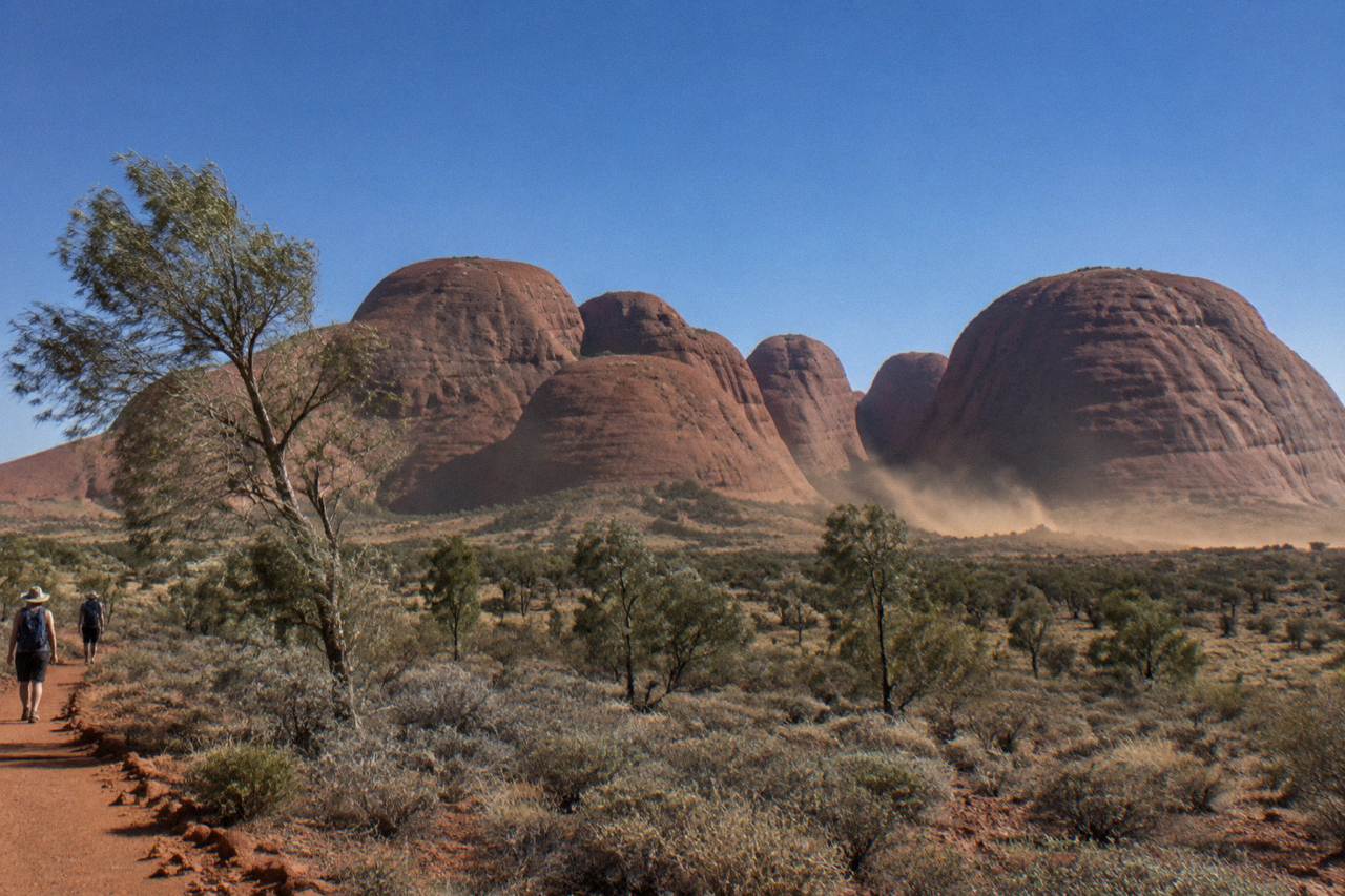
Kata Tjuta is higher. Its tallest dome, measured at 546 metres above the surrounding plain, exceeds Uluru's 348-metre summit. Uluru is a single sandstone monolith with a 9.4-kilometre circumference, while Kata Tjuta is a spread of 36 steep-sided domes covering more than 20 square kilometres. The name Kata Tjuta means 'many heads' in Pitjantjatjara, and the formation is the highest point in the national park. Height isn't everything, though, and the reasons Uluru captivates so many visitors go well beyond its measurements.
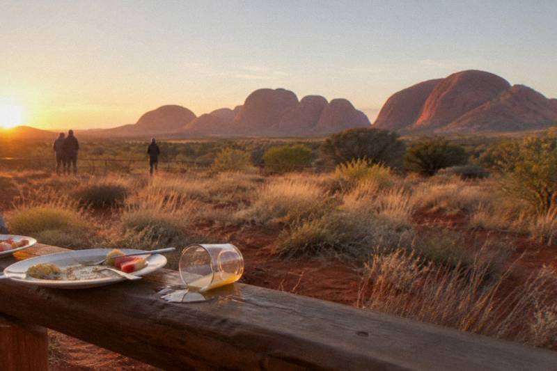
Many travellers arrive at Uluru-Kata Tjuta National Park assuming the bigger name belongs to the bigger rock. Uluru is the one on every postcard, the silhouette that defines the Red Centre. But stand at the Kata Tjuta dune viewing area at sunrise and the scale shift is immediate: the domes rise in a long, jagged line, their highest point punching well above the horizon. At Uluru Australia Tours, we compared the official park figures to settle the question once and for all.
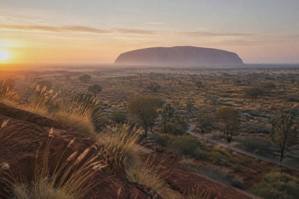
The numbers come straight from Parks Australia. Uluru, the sandstone giant, reaches 348 metres above the plain and has a circumference of 9.4 kilometres. Kata Tjuta, 50 kilometres west by road, is a composite of 36 domes that together cover more than 20 square kilometres; the tallest dome tops out at 546 metres. That makes Kata Tjuta significantly higher, a fact that often rewrites a visitor's mental picture of the park. The domes are not a single block but a deeply eroded remnant of a vast sedimentary fan, their steep walls and narrow gorges carved by millions of years of weather.
The height difference matters for more than trivia. It shapes the walking routes, the sunrise and sunset viewpoints, and the kind of day you'll have. Uluru's base walk is a long, relatively flat circuit; Kata Tjuta's Valley of the Winds is a steep, rocky climb that rewards you with views across the domes (see Base Walk Time). The park's own Kata Tjuta highlights page notes the formation rises up to 546 metres, while the Uluru highlights page confirms the 348-metre figure. Both are worth visiting, and most day tours combine them, but knowing which is taller helps you understand why the park's joint name puts Uluru first only by convention.
The trio of tours above shows the range of ways to see both formations in a single outing. A sunrise small-group tour gets you into the domes early, before the heat builds. A dedicated Valley of the Winds hike tackles the highest parts of Kata Tjuta on foot. And the coach combo from Yulara covers the sunrise at Uluru and then the drive to Kata Tjuta, a practical choice for a first visit. Each one puts the height difference into real perspective.
How Do The Exact Dimensions Compare?
Uluru is 348 metres high and has a circumference of 9.4 kilometres. Kata Tjuta's highest dome reaches 546 metres, and the 36 domes together cover more than 20 square kilometres. Uluru is a single block of sandstone, Kata Tjuta is a cluster of conglomerate domes, and the tallest dome is significantly higher than Uluru's summit.
The table below puts the key measurements side by side. These figures are drawn from the official park pages.
| Measurement | Uluru | Kata Tjuta |
|---|---|---|
| Height above plain | 348 m | 546 m (tallest dome) |
| Circumference / area | 9.4 km circumference | >20 km² total area |
| Number of rock formations | 1 monolith | 36 domes |
| Rock type | Sandstone arkose | Conglomerate |
| Distance from Yulara | 18 km by road | 50 km by road |
Both formations are ancient, dating back hundreds of millions of years. Uluru is a hardened sandstone arkose, while Kata Tjuta is a coarse conglomerate of granite, basalt, and other rock fragments cemented together. That difference in composition explains why Uluru weathers into smooth, curving flanks and Kata Tjuta fractures into steep, blocky domes.
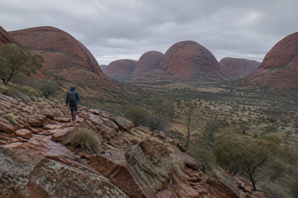
The height of Kata Tjuta is not just a single peak: several domes exceed 500 metres, and the highest is the one you see from the Valley of the Winds lookout. Uluru, by contrast, is a single summit, closed to climbing since October 2019, so its height is now experienced from the base. The park's opening hours shift by month, with October hours from 5:00 am to 8:00 pm, giving plenty of daylight to visit both sites in one day. Entry requires a park pass, which costs $38 for an adult for three consecutive days and is valid for Uluru-Kata Tjuta National Park only.
Many visitors ask whether the height difference makes Kata Tjuta harder to explore. The answer is yes, in terms of walking effort, but the reward is a completely different perspective. The next section covers the walking routes and how they compare. For a full breakdown of the best Kata Tjuta walks and tour options, see our Kata Tjuta tours guide.
What Are The Best Ways To See Both Formations In One Day?
The most efficient way to see both in a single day is a guided tour that covers Uluru at sunrise or sunset and Kata Tjuta during the cooler morning hours. The park's two main sites are 50 kilometres apart by sealed road, and a tour with transport eliminates the need to drive yourself. Two formats cover both sites in one morning: a small-group sunrise tour with breakfast at Kata Tjuta, or a coach combo that starts at Uluru.
The drive from Yulara to Uluru takes about 20 minutes; from Uluru to Kata Tjuta is another 30 minutes west. That means a self-drive day is entirely possible, but a tour adds the guide's knowledge and often includes meals, park entry logistics, and a carefully timed itinerary. The park's official sunrise and sunset viewing areas are free to enter with a pass, but they fill early, and a tour guarantees a spot.
The Kata Tjuta Small-Group Sunrise Tour with Breakfast, operated by SEIT Tours, is the featured option for seeing both sites in a single morning. It departs Yulara well before dawn, drives directly to the Kata Tjuta dune viewing area for sunrise, then leads a guided walk into Walpa Gorge or a section of the Valley of the Winds. A light breakfast is served on site, and the tour returns to the resort by mid-morning, leaving the afternoon free for Uluru. The listing carries a 4.8 rating from 255 reviews and starts from A$249 per person, with a cancellation cutoff of six days before the start.
For a larger-group option that covers both sites in a single coach trip, the Bus Sunrise, Kata Tjuta Combo by AAT Kings runs five hours, includes the sunrise at Uluru and then the drive to Kata Tjuta, and costs from A$186 per person with a 4.6 rating from 603 reviews. The coach format means a larger group, but the commentary is thorough and the schedule is reliable. Its cancellation cutoff is 24 hours before the start, a shorter window than the small-group tour, so check the listing before booking.
If you prefer to hike the highest parts of Kata Tjuta, the Valley of the Winds Circuit Hike is a small-group tour that focuses entirely on the domes. It takes about five hours, starts from A$249 per person, and has a 4.9 rating from 30 reviews. The guided walk reaches the Karingana lookout, which sits high above the plain and gives a clear view of the height difference relative to Uluru on the horizon.
The park's seasonal opening hours shift through the year, with October's 5:00 am to 8:00 pm window offering long daylight for a two-site day. In summer, the heat builds quickly, and the park advises against walking after 11:00 am. A tour that starts at sunrise avoids the worst of the heat and gets you back to the resort by lunchtime.
How Do The Walking Routes At Uluru And Kata Tjuta Compare?
Uluru's base walk is a flat 10-kilometre circuit on compacted earth, taking about 3 to 4 hours, while Kata Tjuta's Valley of the Winds is a Grade 4 rocky climb of up to 7.4 kilometres, with steep sections and loose stones. The shorter Walpa Gorge walk at Kata Tjuta is an easier 2.6-kilometre return route through a shaded gorge. Uluru's walk is about endurance; Kata Tjuta's is about elevation.
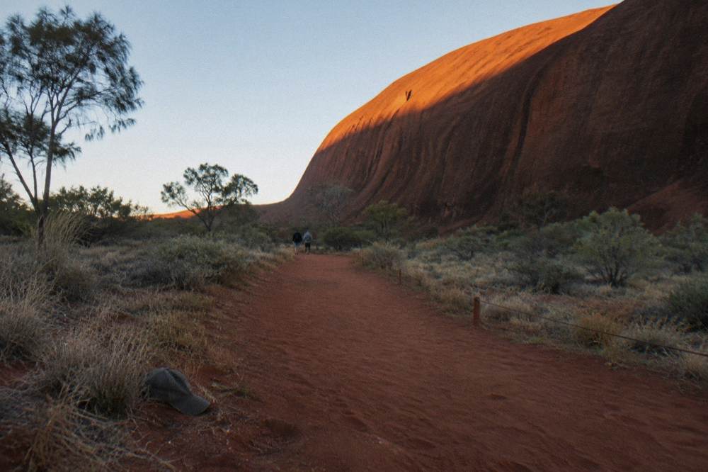
The Uluru base walk starts at the Mala carpark and circles the monolith clockwise. It passes several culturally significant sites, including the Mala walk, the north-east face, Kuniya walk to Mutitjulu Waterhole, and Lungkata walk. The track is mostly level, and the full loop takes most walkers three to four hours at a steady pace. In hot weather the park recommends finishing before 11:00 am, and the north-east walk closes from 11:00 am when the temperature reaches 40°C. The ranger-guided Mala walk, free for park visitors, runs at 8:00 am from October to April and is an excellent introduction without the full circuit. Our guide to the Uluru base walk covers the route, safety tips, and what to pack in detail.
Kata Tjuta's Valley of the Winds is a different challenge. The full circuit is 7.4 kilometres, graded 4 by the park, and involves steep rocky steps, uneven surfaces, and exposure to the sun. The first lookout, Karu, is a 2.2-kilometre return trip that takes about an hour. The Karingana lookout, at the far end of the circuit, is 5.4 kilometres return and takes about 2.5 hours. The track climbs steeply from the carpark to the highest lookout, which is why the views feel so commanding. The park's safety advice is to carry at least one litre of water per person per hour, and to avoid walking between 2:30 pm and 6:30 pm in summer.
For an easier Kata Tjuta experience, Walpa Gorge is a 2.6-kilometre return walk along a sandy creek bed between two towering domes. It takes about an hour and is suitable for most fitness levels. A small-group afternoon tour like the 3-Hour Small Group Kata Tjuta Afternoon Tour (rated 4.6 from 150 reviews, from A$185 per person) focuses on Walpa Gorge and includes commentary on the geology and plant life.
The contrast in walking style between the two sites is one reason many visitors choose a guided tour. A guide can read the weather, set the right pace, and point out features that self-guided walkers miss. The SEIT small-group tours, for instance, limit group size to keep the experience personal, and the guides are trained in the park's cultural protocols. The park is jointly managed by the Anangu Traditional Owners and Parks Australia, guided by Tjukurpa, the foundation of Anangu law and culture. Visitors are asked to respect cultural protocols, including photography restrictions at certain sites, and to stay on marked tracks.
What Else Should You Know Before Visiting Both Formations?
You need a park pass, available online for $38 per adult for three days, and you should pre-purchase it to scan at the entry station. The two sites are 50 kilometres apart, so plan your day around the park's opening hours and the heat. Flies are heavy from September to April, and a head net is a small but essential purchase at the resort.
The park pass is not included in any tour's price; every listing states the fee separately and directs you to buy it online before arrival. The pass is valid for three consecutive days, and children under 18 enter free. The revenue is reinvested in park operations and Traditional Owner lease payments. You can buy the pass at the entry station, but the park encourages online purchase to speed up entry.
The climate at Yulara is extreme. Summer daytime temperatures regularly exceed 35°C, and the Bureau of Meteorology outlook for October to December 2026 favours above-average temperatures across the region. The UV index reaches 11, extreme, even in early October. Sun protection, a wide-brimmed hat, and at least one litre of water per person per hour are non-negotiable. The park's safety page advises against walking between 2:30 pm and 6:30 pm in summer, and emergency call devices are located on most major walks.
Bush flies are present from September to April, and they can be relentless on still days. Head nets are sold at the resort shops and are a small investment that makes a big difference to your comfort. The piriyakutu season, usually August to October, is when food plants flower and the park's wildlife is most active, but it is also the tail end of the fly season.
The park's Cultural Centre, open from 7:00 am to 5:45 pm daily, is a good stop between sites. It houses displays on Anangu culture, the Tjukurpa, and the joint management of the park. Entry is free with a park pass. The centre also has a café and toilets, making it a practical rest point. The free ranger-guided Mala walk, offered daily at 8:00 am from October to April, starts nearby and gives an excellent overview of the rock's cultural significance without a paid tour.
For those staying multiple days, a hop-on hop-off bus pass (from A$140 per person, 4.5 rating from 154 reviews) gives you flexible transport between Yulara, Uluru, and Kata Tjuta. It runs on a loop and lets you spend as long as you want at each site, though you still need to be out of the park by closing time.
The hop-on hop-off format suits independent travellers who want to walk the base of Uluru in the morning and then take the bus to Kata Tjuta for the afternoon. The last bus leaves Kata Tjuta in time to clear the park before closing, and the timetable is published on the operator's listing.
Common Questions About Uluru And Kata Tjuta
Which Is Higher, Uluru Or Kata Tjuta?
Kata Tjuta is higher. Its tallest dome reaches 546 metres above the plain, while Uluru stands 348 metres high. Uluru is a single monolith with a 9.4-kilometre circumference; Kata Tjuta is a cluster of 36 domes spanning more than 20 square kilometres.
Can You Walk To The Top Of Either Formation?
No. The Uluru climb closed permanently in October 2019, and climbing is a breach of the EPBC Act. Kata Tjuta has no summit route open to visitors; the highest accessible point is the Karingana lookout on the Valley of the Winds circuit, reached via a marked walking track.
How Far Apart Are Uluru And Kata Tjuta?
The two sites are 50 kilometres apart by sealed road. The drive from the Uluru base to the Kata Tjuta carpark takes about 30 minutes. From Yulara, Uluru is 18 kilometres and Kata Tjuta is 50 kilometres.
Is Kata Tjuta Harder To Walk Than Uluru?
Yes. The Uluru base walk is a flat 10-kilometre circuit on compacted earth, while Kata Tjuta's Valley of the Winds is a Grade 4 rocky climb with steep sections. Walpa Gorge at Kata Tjuta is an easier 2.6-kilometre return walk suitable for most fitness levels.
Do I Need A Park Pass To Visit Both?
Yes. A park pass costs $38 per adult for three consecutive days and is valid for Uluru-Kata Tjuta National Park only. Children under 18 enter free. The pass must be purchased online or at the entry station, and tour prices do not include it.
What Is The Best Time Of Day To See Both?
Sunrise at Kata Tjuta and sunset at Uluru is the classic combination. The Kata Tjuta dune viewing area faces east and catches the first light on the domes, while the Uluru sunset viewing areas face west and show the rock changing colour as the sun drops. A guided tour that covers both in one day typically starts before dawn.
The three tours above cover the full spectrum: a small-group sunrise with breakfast inside the domes, a dedicated hike to the highest lookout, and a coach combo that hits both sites in one efficient morning. Whichever you choose, the numbers are clear: Kata Tjuta is the taller formation, and seeing both in a single day is the best way to understand the scale of this ancient landscape.